PlantKey Open ecological atlas
Planner
Home / Browse / Acanthomintha / Santa Clara Thorn-mint
iNaturalist — CC, credited & licensed per image
Lamiaceae family

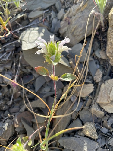
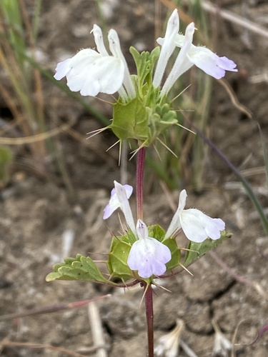
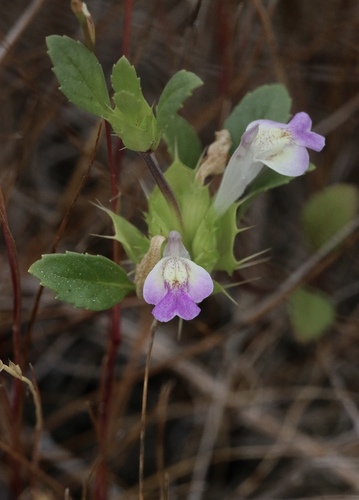
Santa Clara Thorn-mint Acanthomintha lanceolata

Native

Santa Clara Thorn-mint is an annual wildflower native to the lower 48 states. It blooms Apr – Jun.

More about this plant

Acanthomintha lanceolata is a species of flowering plant in the mint family known by the common name Santa Clara thornmint. It is endemic to California, where it is known from several counties surrounding and south of the San Francisco Bay Area. It is an uncommon resident of rocky habitat in coastal and inland mountain ranges. Wikipedia →

Growing & care

USDA PLANTS · TRY
Conditions
Sources · Conditions
Cold hardiness (derived) — Hardiness
Hardiness
≥ zone 11 derived from its U.S. range
Size & form
Sources · Size & form
USDA PLANTS — Lifespan
Lifespan
Annual
In the garden
Herb layer — Sits in the herb of a layered food forest or polyculture.Open guide →
derived roles
The garden year bloom → fruit → fall colour
J
F
M
A
M
J
J
A
S
O
N
D
Bloom
Bloom (the flower's colour)
Bloom · Apr – Jun — 74 obs · Herbarium specimens — Park et al. 2023 (CC BY 4.0)
Species characteristics from USDA PLANTS (public domain) + TRY (CC BY) — general guidance, not a guarantee for your exact site. Deer "browsing" is documented palatability, not a deer-proof claim.
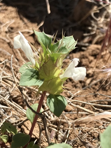
How we know this (1) Methods & honest limits
Climate niche (heat tolerance & native rainfall) Derived

We take the plant’s U.S. county range and look up each county’s long-term climate, then summarise: native rainfall = the median annual rainfall across its counties; heat tolerance = the warm end (90th percentile) of average temperature across its range (mirroring how our cold-hardiness floor uses an extreme). Counties + medians blunt the roadside/observer bias that makes point-level climate unreliable. Needs at least five placeable counties.

Honest limits: A realized, sampling-biased niche (where it has been recorded, not its physiological optimum), and county climate is coarse — large Western counties span deserts and mountains. Derived guide, never a measured fact.

Realized-niche / climate-envelope approach (Pearson & Dawson 2003; Soberón 2007). Climate: NOAA NCEI nClimDiv county normals (1991–2020).
Derived values are computed from open data by a published method — labelled, cited, and never shown as a direct observation. Full methodology →
Sources for this entry (12) Open & cited
[01] Scientific name & family — USDA PLANTS (DwCA, Zenodo 17903503)
[02] Growth habit & duration — USDA PLANTS (DwCA, Zenodo 17903503)
[03] Native status & distribution — USDA PLANTS (DwCA, Zenodo 17903503)
[04] Common name — USDA PLANTS (via GBIF)
[05] Invasive / introduced status — USDA PLANTS (DwCA, Zenodo 17903503) — native status
[07] Description — Wikipedia (CC BY-SA)
[09] Conservation rank — NatureServe Explorer (CC BY)
[10] Climate niche — Derived — realized climate niche from U.S. county occurrences (GBIF) × NOAA NCEI county climate normals 1991–2020 (public domain)
[11] Cold hardiness (derived) — Derived from U.S. range × USDA PHZM zones
[12] County range — GBIF Open Data — open-licensed occurrences (CC0/CC-BY) → county
Spot an error or have a better photo? Every field links to its source, and the whole dataset is open.
Cite this page Open data, please attribute

PlantKey’s data is open under CC BY-SA 4.0 — free to reuse and adapt, with attribution and the same licence. Photos keep their own per-image licence + credit (see Sources above).

Citation

Loading…

BibTeX
Loading…