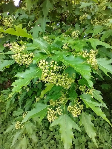
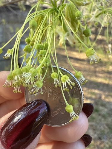
Tatarian Maple Acer tataricum
Tatarian Maple is an introduced perennial tree, found in the lower 48 states. It grows to 22 ft.
More about this plant
Acer tataricum, the Tatar maple or Tatarian maple, is a species of maple widespread across central and southeastern Europe and temperate Asia, from Austria and Turkey, and in some circumscriptions, with a disjunct population in eastern Asia in northern and central China, Japan and the Russian Far East. The species is named after the Tatar peoples of southern Russia; the tree's name is similarly commonly also misspelled "Tartar" or "Tartarian" in English. Wikipedia →
Growing & care
USDA PLANTS · TRY- Hardiness
- ≥ zone 5 derived from its U.S. range
- Drought tolerance
- Moderate
- Shade tolerance
- Moderate
- Wet-soil tolerance
- Low waterlogging
- Height
- 22 ft
- Lifespan
- Perennial
- Foliage
- Deciduous broadleaf
Wildlife & pollinators
How pollinator value is scored →❧ Caterpillar hosts ~297 caterpillar species · keystone genus
Acer supports ~297 caterpillar species.
Native butterfly & moth caterpillars are the base of the terrestrial food web — most songbirds rear their young almost entirely on them. As a host for native Lepidoptera this is a powerhouse genus.
Recorded feeding on Acer in North America, including:
")
")
 Clarke · CC BY-NC — iNaturalist (CC)")
")
")
+ 8 more species → ↑ show fewer
")
")
")
")
")
")
")
✦ Bees 9 bee visitors
9 native & managed bee species are documented visiting Tatarian Maple :
")
")
")
")
")
+ 3 more bees → ↑ show fewer
")
")
")
Wildlife & visitors 2 birds
Open records of who else uses Tatarian Maple — a generalist food-web signal, kept separate from the keystone Ecological Value.
Recorded eaten by 2 birds species (fruit, seed, browse):
")
")
Related plants
More Acer →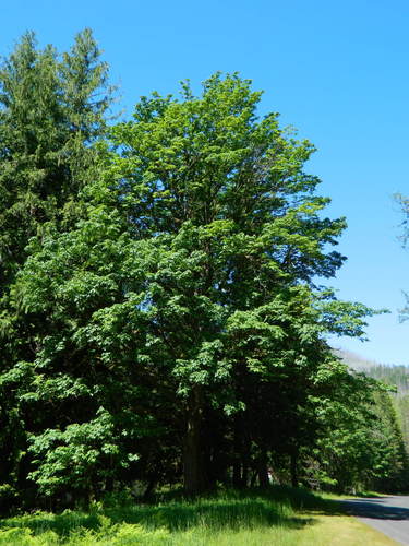

How we know this (2) Methods & honest limits
A recorded categorical fact: each species is tagged C3 (standard), C4 (heat/water-efficient) or CAM (succulent, night-time CO₂ uptake) — or a facultative combination. We only show a trait card for the noteworthy C4/CAM cases; C3 is the unremarkable majority, kept in the data but not surfaced as a card.
We take the plant’s U.S. county range and look up each county’s long-term climate, then summarise: native rainfall = the median annual rainfall across its counties; heat tolerance = the warm end (90th percentile) of average temperature across its range (mirroring how our cold-hardiness floor uses an extreme). Counties + medians blunt the roadside/observer bias that makes point-level climate unreliable. Needs at least five placeable counties.
Honest limits: A realized, sampling-biased niche (where it has been recorded, not its physiological optimum), and county climate is coarse — large Western counties span deserts and mountains. Derived guide, never a measured fact.
Sources for this entry (24) Open & cited
Cite this page Open data, please attribute
PlantKey’s data is open under CC BY-SA 4.0 — free to reuse and adapt, with attribution and the same licence. Photos keep their own per-image licence + credit (see Sources above).
Loading…
BibTeX
Loading…