
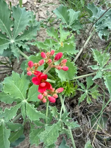
Javanese Bishopwood Bischofia javanica
Javanese Bishopwood is a perennial tree native to the Pacific Basin. It grows to 69 ft.
More about this plant
Bischofia javanica, or bishop wood, is a plant species of the family Phyllanthaceae. It and the related Bischofia polycarpa are the only two members of genus Bischofia and tribe Bischofieae. These species are distributed throughout southern and southeast Asia to Australia and Polynesia also in North America. The tree is commonly used by tigers to scratch-mark territory in the jungles of Assam where it is locally called uriam. They also occur in southwestern, central, eastern, and southern China, and also Taiwan, where the indigenous people consider it a sacred tree. Wikipedia →
Growing & care
USDA PLANTS · TRY- Hardiness
- ≥ zone 11 derived from its U.S. range
- Height
- 69 ft
- Mature width
- ≈ 20 ft wide wild/forest-grown — open-grown specimens spread wider
- Lifespan
- Perennial
- Foliage
- Evergreen broadleaf
Wildlife & pollinators
How pollinator value is scored →Wildlife & visitors 30 birds · 6 mammals
Open records of who else uses Javanese Bishopwood — a generalist food-web signal, kept separate from the keystone Ecological Value.
Recorded eaten by 30 birds and 6 mammals species (fruit, seed, browse) — the most-recorded:
")
")
")
")
")
")
")
")
")
")
")
")
Related plants
More Bischofia →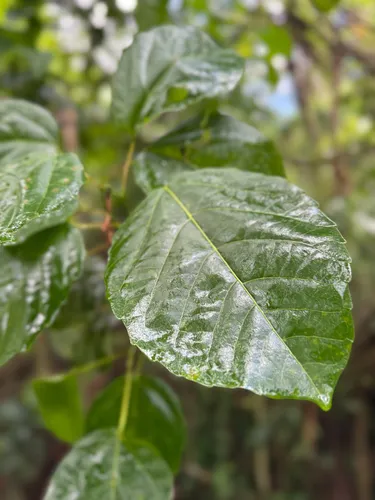
How we know this (3) Methods & honest limits
We read each species’ measured specific leaf area (leaf area per unit dry weight) from the Global Spectrum dataset and band it: thin & fast (high SLA), medium, or thick & tough (low SLA). The global median is about 10 mm²/mg.
Honest limits: A species-mean from pooled measurements — individual plants vary with light and site. A broad strategy signal, not a precise per-plant figure.
A recorded categorical fact: each species is tagged C3 (standard), C4 (heat/water-efficient) or CAM (succulent, night-time CO₂ uptake) — or a facultative combination. We only show a trait card for the noteworthy C4/CAM cases; C3 is the unremarkable majority, kept in the data but not surfaced as a card.
We take the plant’s U.S. county range and look up each county’s long-term climate, then summarise: native rainfall = the median annual rainfall across its counties; heat tolerance = the warm end (90th percentile) of average temperature across its range (mirroring how our cold-hardiness floor uses an extreme). Counties + medians blunt the roadside/observer bias that makes point-level climate unreliable. Needs at least five placeable counties.
Honest limits: A realized, sampling-biased niche (where it has been recorded, not its physiological optimum), and county climate is coarse — large Western counties span deserts and mountains. Derived guide, never a measured fact.
Sources for this entry (19) Open & cited
Cite this page Open data, please attribute
PlantKey’s data is open under CC BY-SA 4.0 — free to reuse and adapt, with attribution and the same licence. Photos keep their own per-image licence + credit (see Sources above).
Loading…
BibTeX
Loading…