PlantKey Open ecological atlas
Planner
Home / Browse / Carex / Wretched Sedge
No openly-licensed photo yetWe add Creative-Commons photos from iNaturalist as they’re published.
Cyperaceae family

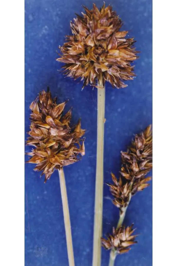
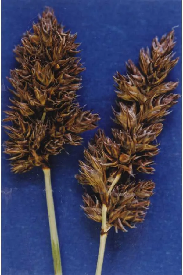
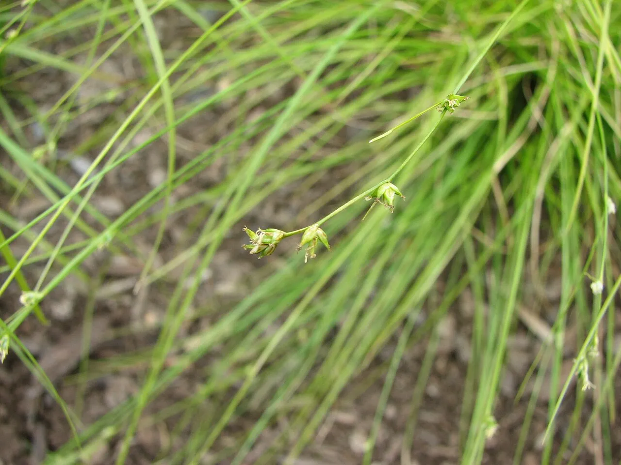
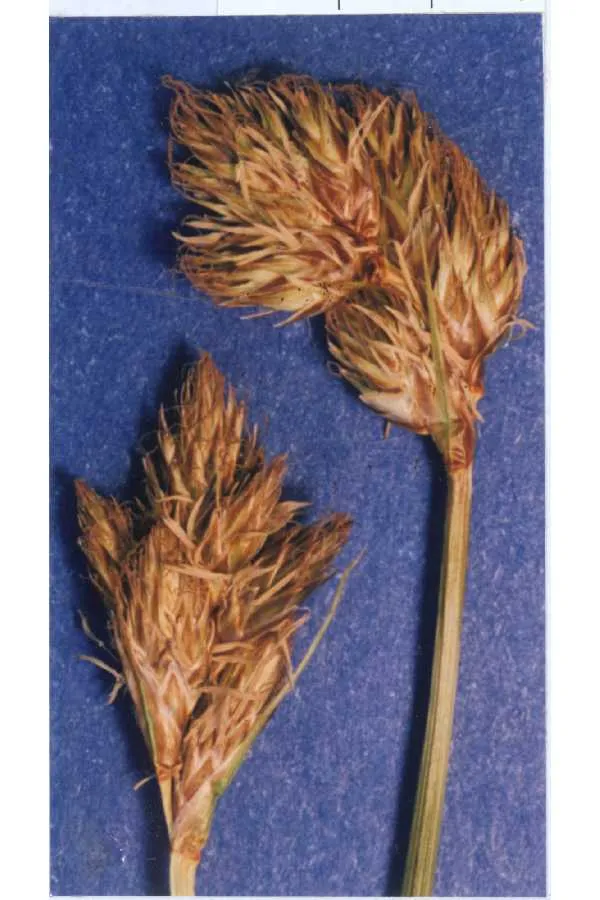
Wretched Sedge Carex misera

Native

Wretched Sedge is a perennial grass native to the lower 48 states.

More about this plant

Carex misera, the wretched sedge, is a species of flowering plant in the family Cyperaceae, native to high elevations in the southern Appalachians. It is found in about 25 locations growing in seeps and other wet situations on rocky ledges, cliff faces, and balds. Wikipedia →

Growing & care

USDA PLANTS · TRY
Conditions
Sources · Conditions
Cold hardiness (derived) — Hardiness
Hardiness
≥ zone 8 derived from its U.S. range
Size & form
Sources · Size & form
USDA PLANTS — Lifespan
Lifespan
Perennial
In the garden
Herb layer — Sits in the herb of a layered food forest or polyculture.Open guide →
derived roles
Species characteristics from USDA PLANTS (public domain) + TRY (CC BY) — general guidance, not a guarantee for your exact site. Deer "browsing" is documented palatability, not a deer-proof claim.

Wildlife & pollinators

How pollinator value is scored →
❧ Caterpillar hosts ~36 caterpillar species

Carex supports ~36 caterpillar species.

Native butterfly & moth caterpillars are the base of the terrestrial food web — most songbirds rear their young almost entirely on them. As a host for native Lepidoptera this is a strong genus.

Keystone count (genus-level) from Warren II 2026 (CC0) · Tallamy host-use records. Named species (a documented Nearctic sample, not exhaustive) from NHM HOSTS (CC0).
Species thumbnails re-hosted from iNaturalist — Creative Commons, credited per image (hover for credit). Click any species to see it on iNaturalist. Not exhaustive; many taxa have no openly-licensed photo yet.
Frequently grows with

Across 30 U.S. vegetation-survey plots that recorded Wretched Sedge, these catalog species turned up most often in the same plot — a real field co-occurrence signal, not a planting prescription.

"%" = share of this plant's plots that also held the species. From sPlotOpen → (Sabatini et al. 2021, CC BY 4.0) — open vegetation plots: wild community composition, not garden design.
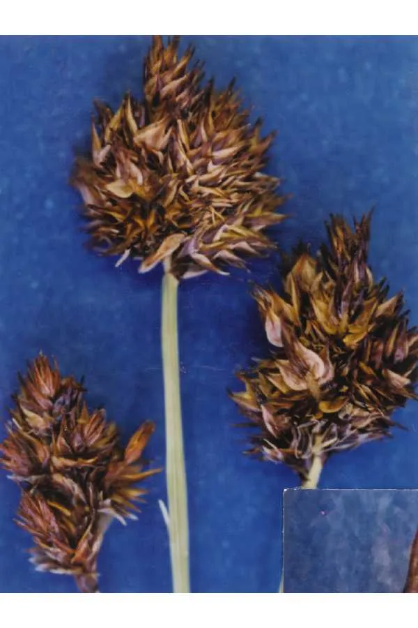
How we know this (1) Methods & honest limits
Climate niche (heat tolerance & native rainfall) Derived

We take the plant’s U.S. county range and look up each county’s long-term climate, then summarise: native rainfall = the median annual rainfall across its counties; heat tolerance = the warm end (90th percentile) of average temperature across its range (mirroring how our cold-hardiness floor uses an extreme). Counties + medians blunt the roadside/observer bias that makes point-level climate unreliable. Needs at least five placeable counties.

Honest limits: A realized, sampling-biased niche (where it has been recorded, not its physiological optimum), and county climate is coarse — large Western counties span deserts and mountains. Derived guide, never a measured fact.

Realized-niche / climate-envelope approach (Pearson & Dawson 2003; Soberón 2007). Climate: NOAA NCEI nClimDiv county normals (1991–2020).
Derived values are computed from open data by a published method — labelled, cited, and never shown as a direct observation. Full methodology →
Sources for this entry (14) Open & cited
[01] Scientific name & family — USDA PLANTS (DwCA, Zenodo 17903503)
[02] Growth habit & duration — USDA PLANTS (DwCA, Zenodo 17903503)
[03] Native status & distribution — USDA PLANTS (DwCA, Zenodo 17903503)
[04] Common name — USDA PLANTS (via GBIF)
[05] Invasive / introduced status — USDA PLANTS (DwCA, Zenodo 17903503) — native status
[06] Description — Wikipedia (CC BY-SA)
[07] Ecological value — Warren II 2026 (CC0) · Tallamy host-use counts
[08] Conservation rank — NatureServe Explorer (CC BY)
[09] Climate niche — Derived — realized climate niche from U.S. county occurrences (GBIF) × NOAA NCEI county climate normals 1991–2020 (public domain)
[10] Cold hardiness (derived) — Derived from U.S. range × USDA PHZM zones
[11] Caterpillar host count — Warren II 2026 (Dryad, CC0) · Tallamy host-use counts
[12] Caterpillar species — NHM HOSTS (CC0)
[13] County range — GBIF Open Data — open-licensed occurrences (CC0/CC-BY) → county
Spot an error or have a better photo? Every field links to its source, and the whole dataset is open.
Cite this page Open data, please attribute

PlantKey’s data is open under CC BY-SA 4.0 — free to reuse and adapt, with attribution and the same licence. Photos keep their own per-image licence + credit (see Sources above).

Citation

Loading…

BibTeX
Loading…