
© Dean Lyons · CC BY-NC
iNaturalist — CC, credited & licensed per image
Poaceae family
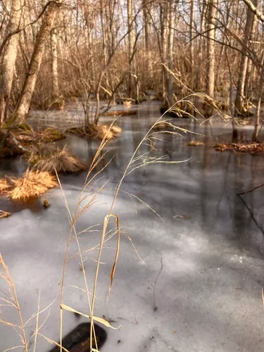
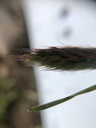
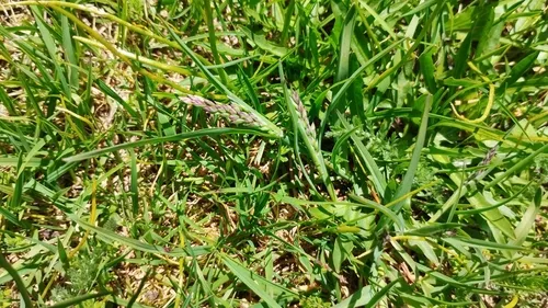
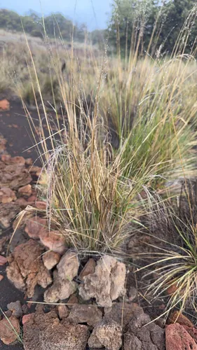
Bolander's Woodreed Cinna bolanderi
Native
Bolander's Woodreed is a perennial grass native to the lower 48 states.
More about this plant
Cinna bolanderi is a species of grass known by the common names Bolander's woodreed and Sierran woodreed. It is endemic to the Sierra Nevada of California, where it grows in meadows and forest, especially in moist areas. It can reach two meters in height and has a spreading inflorescence of spikelets. It blooms in late summer and fall. Wikipedia →
Growing & care
USDA PLANTS · TRY Conditions
Sources · Conditions
Cold hardiness (derived) — Hardiness
- Hardiness
- ≥ zone 11 derived from its U.S. range
Size & form
Sources · Size & form
USDA PLANTS — Lifespan
TRY Plant Trait Database (CC BY 4.0) — Foliage
- Lifespan
- Perennial
- Foliage
- Broadleaf
In the garden
Herb layer — Sits in the herb of a layered food forest or polyculture.Open guide →
Rain garden / bioswale — Rated FACW on the wetland list — tolerates wet feet, so it suits the soggy zone of a rain garden or bioswale that catches and filters runoff.Open guide →
derived roles
Species characteristics from USDA PLANTS (public domain) + TRY (CC BY) — general guidance, not a
guarantee for your exact site. Deer "browsing" is documented palatability, not a deer-proof claim.
Related plants
More Cinna →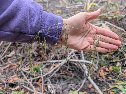
Native
Drooping Woodreed
Cinna latifolia
●○○○○ 
Native
Sweet Woodreed
Cinna arundinacea
●○○○○ 
Native
Alaska Bluegrass
Poa paucispicula
●●●○○ 
Native
Alaskan Wheatgrass
Elymus alaskanus
●●●○○ 
Native
Alpine Bluegrass
Poa alpina
●●●○○ 
Native
Alpine Hairgrass
Deschampsia nubigena
●●●○○ Same genus / family, ranked by ecological value — from the PlantKey catalog
Sources for this entry (13) Open & cited
[01] Scientific name & family — USDA PLANTS (DwCA, Zenodo 17903503)
[02] Growth habit & duration — USDA PLANTS (DwCA, Zenodo 17903503)
[03] Native status & distribution — USDA PLANTS (DwCA, Zenodo 17903503)
[04] Common name — USDA PLANTS (via GBIF)
[05] Invasive / introduced status — USDA PLANTS (DwCA, Zenodo 17903503) — native status
[06] Wetland indicator — USACE National Wetland Plant List (2022)
[07] Photos — iNaturalist — CC, credited per image
[08] Description — Wikipedia (CC BY-SA)
[09] Ecological value — GloBI
[10] Conservation rank — NatureServe Explorer (CC BY)
[11] Foliage — TRY Plant Trait Database (CC BY 4.0)
[12] Cold hardiness (derived) — Derived from U.S. range × USDA PHZM zones
[13] County range — GBIF Open Data — open-licensed occurrences (CC0/CC-BY) → county
Spot an error or have a better photo? Every field links to its source, and the whole dataset is open.
Cite this page Open data, please attribute
PlantKey’s data is open under CC BY-SA 4.0 — free to reuse and adapt, with attribution and the same licence. Photos keep their own per-image licence + credit (see Sources above).
Citation
Loading…
BibTeX
Loading…