
Great Basin Calicoflower Downingia laeta
Great Basin Calicoflower is an annual wildflower native to Canada and the lower 48 states. It grows to 0.8 ft and blooms May in part shade – shade, with brown fruit.
More about this plant
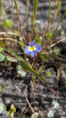
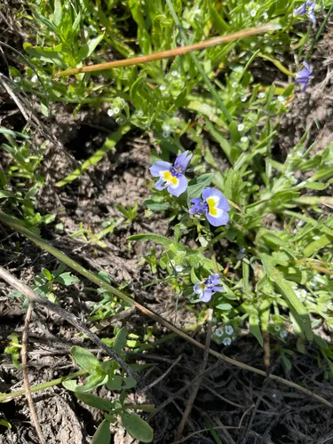
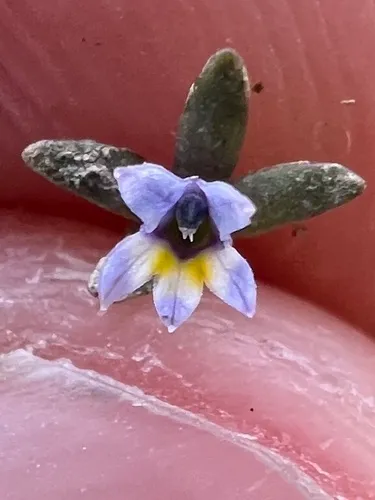
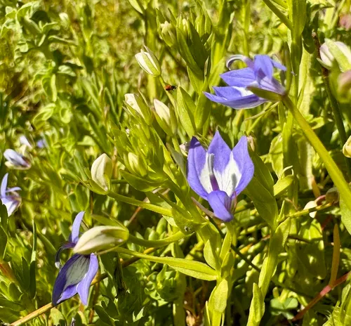
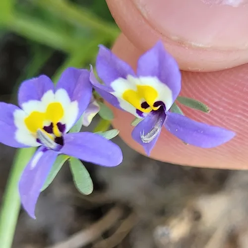
Downingia laeta is a species of flowering plant in the bellflower family known by the common name Great Basin calicoflower. This showy wildflower is native to western North America from California to Saskatchewan, where it is a resident of riverbanks, ponds, and vernal pool ecosystems. This annual grows on a thick erect stem with a few short, pointed leaves. Atop the stem is usually a single flower, which has an upper lip made up of two narrow, pointed lobes in shades of very light blue or purple, or white, and a lower lip which is a fusion of three lobes in the same color with two bright yellow spots and sometimes some purple or pink blotches or streaking. Wikipedia →
Growing & care
USDA PLANTS · TRY- Sun
- Part shade – shade
- Soil & moisture
- High moisture
- Soil pH
- 6.4–7.9
- Fertility need
- Low
- Adapts to
- Medium (loam), Fine (clay)
- Hardiness
- USDA zone 13+
- Height
- 0.8 ft
- Spread
- Moderate
- Growth rate
- Rapid
- Growth form
- Stoloniferous
- Lifespan
- Annual
- Foliage
- Broadleaf · coarse texture
- Active growth
- Spring & summer
- Fruit
- Brown
- Flower colour
- White AI AI image-analysis of community-science photos (~87% expert agreement) — not a botanical record
- Propagate by
- Seed
- Seed starting
- No stratification needed
- Seeds ripen
- Summer seed-collection / harvest window
- In the trade
- No known commercial source
- Resprouts if cut
- No
Sow timing keys off your local last- and first-frost dates.
Related plants
More Downingia →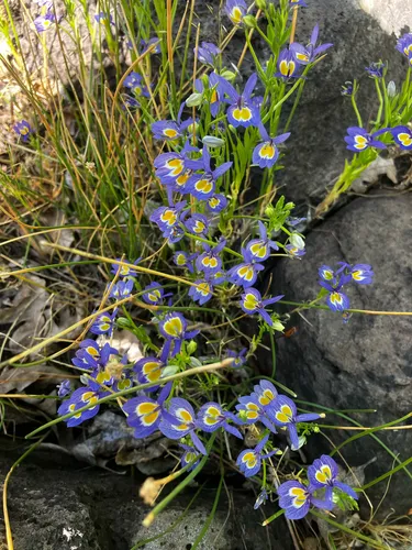
How we know this (3) Methods & honest limits
A recorded categorical fact: each species is tagged C3 (standard), C4 (heat/water-efficient) or CAM (succulent, night-time CO₂ uptake) — or a facultative combination. We only show a trait card for the noteworthy C4/CAM cases; C3 is the unremarkable majority, kept in the data but not surfaced as a card.
We take the plant’s U.S. county range and look up each county’s long-term climate, then summarise: native rainfall = the median annual rainfall across its counties; heat tolerance = the warm end (90th percentile) of average temperature across its range (mirroring how our cold-hardiness floor uses an extreme). Counties + medians blunt the roadside/observer bias that makes point-level climate unreliable. Needs at least five placeable counties.
Honest limits: A realized, sampling-biased niche (where it has been recorded, not its physiological optimum), and county climate is coarse — large Western counties span deserts and mountains. Derived guide, never a measured fact.
McKenzie et al. assigned each species a flower colour with a GPT-4V vision model over iNaturalist photos. We use the confident tier plus a separately-labelled lower-confidence top-up (mostly inconspicuous green/brown flowers), and render it as a small tint — never as an asserted fact, and kept out of the written synopsis.
Honest limits: AI image inference (~87% expert agreement on the confident tier); a decorative, confidence-tiered indicator, not a measured trait.
Sources for this entry (29) Open & cited
Cite this page Open data, please attribute
PlantKey’s data is open under CC BY-SA 4.0 — free to reuse and adapt, with attribution and the same licence. Photos keep their own per-image licence + credit (see Sources above).
Loading…
BibTeX
Loading…