PlantKey Open ecological atlas
Planner
Home / Browse / Ionactis / Lava Aster
iNaturalist — CC, credited & licensed per image
Asteraceae family

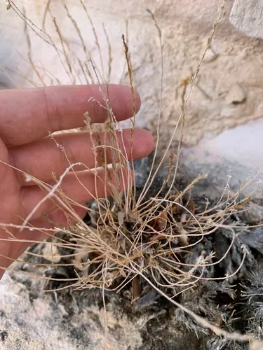
Lava Aster Ionactis alpina

Native

Lava Aster is a perennial shrub native to the lower 48 states. It grows to 0.4 ft and blooms May – Jul.

More about this plant

Ionactis alpina is a species of flowering plant in the family Asteraceae known by the common name lava aster. It is native to western United States from California to Montana, where it grows in dry areas. Wikipedia →

Growing & care

USDA PLANTS · TRY
Conditions
Sources · Conditions
Cold hardiness (derived) — Hardiness
Hardiness
≥ zone 6 derived from its U.S. range
Size & form
Sources · Size & form
TRY Plant Trait Database (CC BY 4.0) — Height · Foliage
USDA PLANTS — Lifespan
McKenzie et al. 2025 — community-science image analysis (MIT) — Flower colour
Height
0.4 ft
Lifespan
Perennial
Foliage
Broadleaf
Flower colour
Purple AI AI image-analysis of community-science photos (~87% expert agreement) — not a botanical record
In the garden
Ground-cover layer — Sits in the ground-cover of a layered food forest or polyculture.Open guide →
derived roles
AI = read by an AI vision model · DERIVED = a computed estimate, not a direct measurement. The “How we know this” section below details each.
The garden year bloom → fruit → fall colour
J
F
M
A
M
J
J
A
S
O
N
D
Bloom
Bloom (the flower's colour)
Bloom · May – Jul — 139 obs · Herbarium specimens — Park et al. 2023 (CC BY 4.0)
Species characteristics from USDA PLANTS (public domain) + TRY (CC BY) — general guidance, not a guarantee for your exact site. Deer "browsing" is documented palatability, not a deer-proof claim.
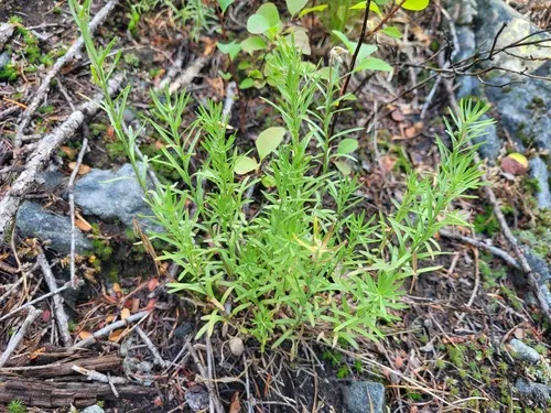
How we know this (2) Methods & honest limits
Climate niche (heat tolerance & native rainfall) Derived

We take the plant’s U.S. county range and look up each county’s long-term climate, then summarise: native rainfall = the median annual rainfall across its counties; heat tolerance = the warm end (90th percentile) of average temperature across its range (mirroring how our cold-hardiness floor uses an extreme). Counties + medians blunt the roadside/observer bias that makes point-level climate unreliable. Needs at least five placeable counties.

Honest limits: A realized, sampling-biased niche (where it has been recorded, not its physiological optimum), and county climate is coarse — large Western counties span deserts and mountains. Derived guide, never a measured fact.

Realized-niche / climate-envelope approach (Pearson & Dawson 2003; Soberón 2007). Climate: NOAA NCEI nClimDiv county normals (1991–2020).
Flower colour Derived

McKenzie et al. assigned each species a flower colour with a GPT-4V vision model over iNaturalist photos. We use the confident tier plus a separately-labelled lower-confidence top-up (mostly inconspicuous green/brown flowers), and render it as a small tint — never as an asserted fact, and kept out of the written synopsis.

Honest limits: AI image inference (~87% expert agreement on the confident tier); a decorative, confidence-tiered indicator, not a measured trait.

McKenzie, P., Berardi, A.E., Hopkins, R. (2025). flower_color_phenology (MIT).
Derived values are computed from open data by a published method — labelled, cited, and never shown as a direct observation. Full methodology →
Sources for this entry (17) Open & cited
[01] Scientific name & family — USDA PLANTS (DwCA, Zenodo 17903503)
[02] Growth habit & duration — USDA PLANTS (DwCA, Zenodo 17903503)
[03] Native status & distribution — USDA PLANTS (DwCA, Zenodo 17903503)
[04] Common name — USDA PLANTS (via GBIF)
[05] Invasive / introduced status — USDA PLANTS (DwCA, Zenodo 17903503) — native status
[07] Description — Wikipedia (CC BY-SA)
[08] Ecological value — GloBI
[10] Conservation rank — NatureServe Explorer (CC BY)
[13] Functional traits — TRY Plant Trait Database (CC BY 4.0)
[14] Climate niche — Derived — realized climate niche from U.S. county occurrences (GBIF) × NOAA NCEI county climate normals 1991–2020 (public domain)
[15] Cold hardiness (derived) — Derived from U.S. range × USDA PHZM zones
[17] County range — GBIF Open Data — open-licensed occurrences (CC0/CC-BY) → county
Spot an error or have a better photo? Every field links to its source, and the whole dataset is open.
Cite this page Open data, please attribute

PlantKey’s data is open under CC BY-SA 4.0 — free to reuse and adapt, with attribution and the same licence. Photos keep their own per-image licence + credit (see Sources above).

Citation

Loading…

BibTeX
Loading…