PlantKey Open ecological atlas
Planner
Home / Browse / Juglans / Japanese Walnut
iNaturalist — CC, credited & licensed per image
Juglandaceae family

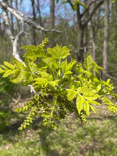
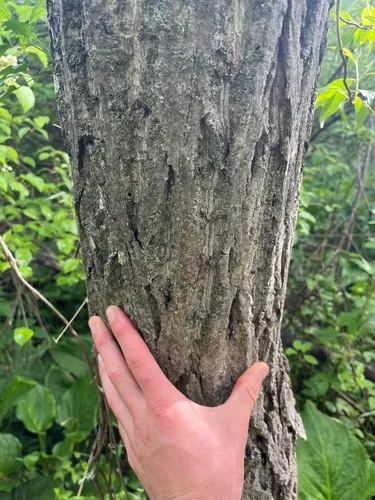
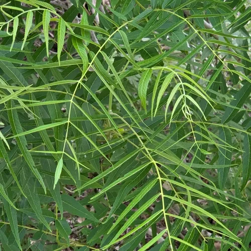
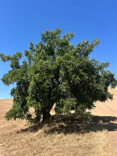
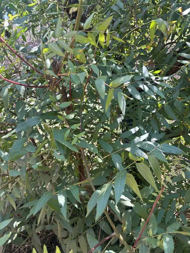
Japanese Walnut Juglans ailantifolia

Japanese Walnut is an introduced perennial tree, found in the lower 48 states.

More about this plant

Juglans ailantifolia, the Japanese walnut, is a species of walnut native to Japan and Sakhalin. Wikipedia →

Growing & care

USDA PLANTS · TRY
Conditions
Sources · Conditions
Cold hardiness (derived) — Hardiness
Hardiness
≥ zone 7 derived from its U.S. range
Size & form
Sources · Size & form
USDA PLANTS — Lifespan
TRY Plant Trait Database (CC BY 4.0) — Foliage
Lifespan
Perennial
Foliage
Deciduous broadleaf
In the garden
Tree layer (canopy / understory) — Sits in the tree of a layered food forest or polyculture.Open guide →
derived roles
Species characteristics from USDA PLANTS (public domain) + TRY (CC BY) — general guidance, not a guarantee for your exact site. Deer "browsing" is documented palatability, not a deer-proof claim.

Wildlife & pollinators

How pollinator value is scored →
❧ Caterpillar hosts ~129 caterpillar species

Juglans supports ~129 caterpillar species.

Native butterfly & moth caterpillars are the base of the terrestrial food web — most songbirds rear their young almost entirely on them. As a host for native Lepidoptera this is an exceptional genus.

Keystone count (genus-level) from Warren II 2026 (CC0) · Tallamy host-use records. Named species (a documented Nearctic sample, not exhaustive) from NHM HOSTS (CC0).
Species thumbnails re-hosted from iNaturalist — Creative Commons, credited per image (hover for credit). Click any species to see it on iNaturalist. Not exhaustive; many taxa have no openly-licensed photo yet.
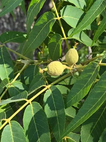
How we know this (2) Methods & honest limits
Photosynthesis Direct fact

A recorded categorical fact: each species is tagged C3 (standard), C4 (heat/water-efficient) or CAM (succulent, night-time CO₂ uptake) — or a facultative combination. We only show a trait card for the noteworthy C4/CAM cases; C3 is the unremarkable majority, kept in the data but not surfaced as a card.

Kattge, J. et al. TRY plant trait database — Categorical Traits Dataset (2012).
Climate niche (heat tolerance & native rainfall) Derived

We take the plant’s U.S. county range and look up each county’s long-term climate, then summarise: native rainfall = the median annual rainfall across its counties; heat tolerance = the warm end (90th percentile) of average temperature across its range (mirroring how our cold-hardiness floor uses an extreme). Counties + medians blunt the roadside/observer bias that makes point-level climate unreliable. Needs at least five placeable counties.

Honest limits: A realized, sampling-biased niche (where it has been recorded, not its physiological optimum), and county climate is coarse — large Western counties span deserts and mountains. Derived guide, never a measured fact.

Realized-niche / climate-envelope approach (Pearson & Dawson 2003; Soberón 2007). Climate: NOAA NCEI nClimDiv county normals (1991–2020).
Derived values are computed from open data by a published method — labelled, cited, and never shown as a direct observation. Full methodology →
Sources for this entry (15) Open & cited
[01] Scientific name & family — USDA PLANTS (DwCA, Zenodo 17903503)
[02] Growth habit & duration — USDA PLANTS (DwCA, Zenodo 17903503)
[03] Native status & distribution — USDA PLANTS (DwCA, Zenodo 17903503)
[04] Common name — USDA PLANTS (via GBIF)
[05] Invasive / introduced status — US-RIIS v2.0 (USGS)
[07] Description — Wikipedia (CC BY-SA)
[08] Ecological value — Warren II 2026 (CC0) · Tallamy host-use counts
[10] Photosynthetic pathway — TRY Plant Trait Database (CC BY 4.0)
[11] Climate niche — Derived — realized climate niche from U.S. county occurrences (GBIF) × NOAA NCEI county climate normals 1991–2020 (public domain)
[12] Cold hardiness (derived) — Derived from U.S. range × USDA PHZM zones
[13] Caterpillar host count — Warren II 2026 (Dryad, CC0) · Tallamy host-use counts
[14] Caterpillar species — NHM HOSTS (CC0)
[15] County range — GBIF Open Data — open-licensed occurrences (CC0/CC-BY) → county
Spot an error or have a better photo? Every field links to its source, and the whole dataset is open.
Cite this page Open data, please attribute

PlantKey’s data is open under CC BY-SA 4.0 — free to reuse and adapt, with attribution and the same licence. Photos keep their own per-image licence + credit (see Sources above).

Citation

Loading…

BibTeX
Loading…