
© Liam Conley · CC BY-NC
iNaturalist — CC, credited & licensed per image
Fabaceae family
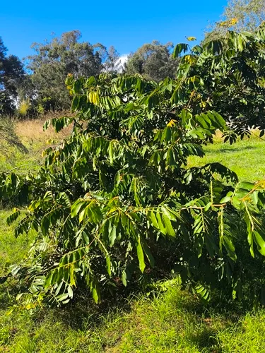
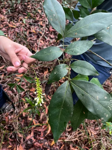
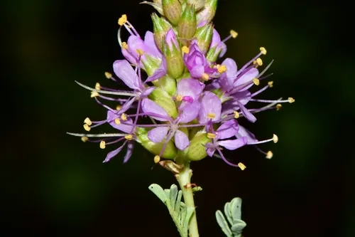
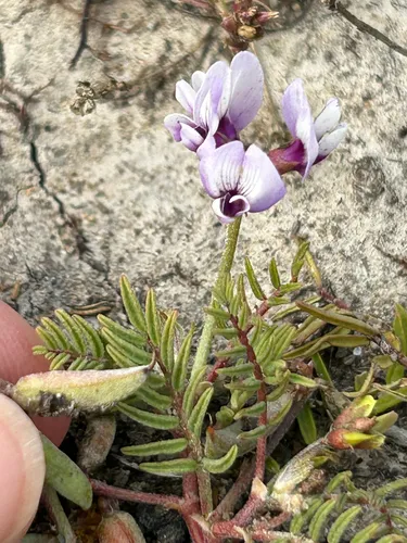
Milfoil Wattle Mariosousa millefolia
Native
Milfoil Wattle is a plant native to the lower 48 states.
Growing & care
USDA PLANTS · TRY Conditions
Sources · Conditions
Cold hardiness (derived) — Hardiness
- Hardiness
- ≥ zone 8 derived from its U.S. range
Species characteristics from USDA PLANTS (public domain) + TRY (CC BY) — general guidance, not a
guarantee for your exact site. Deer "browsing" is documented palatability, not a deer-proof claim.
Wildlife & pollinators
How pollinator value is scored →✦ Bees 10 bee visitors
10 native & managed bee species are documented visiting Milfoil Wattle :
")
")
")
")
+ 4 more bees → ↑ show fewer
")
")
Visitor records (observations, not exhaustive) from Noori et al. 2026 (CC BY 4.0) ·
GloBI →
Wildlife & visitors 1 nectaring
Open records of who else uses Milfoil Wattle — a generalist food-web signal, kept separate from the keystone Ecological Value.
1 adult butterfly & moth species is recorded nectaring at its flowers:
")
Interaction records (observations, not exhaustive) from
GloBI → (CC0). Counts are distinct species; names are the most-recorded. Common names from Wikidata (CC0).
Species thumbnails re-hosted from iNaturalist — Creative Commons, credited per image (hover for credit). Click any species to see it on iNaturalist. Not exhaustive; many taxa have no openly-licensed photo yet.
Related plants
More Mariosousa →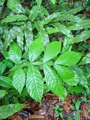
Native
Icecream Bean
Inga ingoides
●●●●● 
Native
River Koko
Inga vera
●●●●● 
Native
Sacky Sac Bean
Inga laurina
●●●●● 
Native
Ackerman's Milkvetch
Astragalus ackermanii
●●●●○ 
Native
Albuquerque Prairie Clover
Dalea scariosa
●●●●○ 
Native
Alkali Milkvetch
Astragalus tener
●●●●○ Same genus / family, ranked by ecological value — from the PlantKey catalog
Sources for this entry (11) Open & cited
[01] Scientific name & family — USDA PLANTS (DwCA, Zenodo 17903503)
[02] Growth habit & duration — USDA PLANTS (DwCA, Zenodo 17903503)
[03] Native status & distribution — USDA PLANTS (DwCA, Zenodo 17903503)
[04] Common name — USDA PLANTS (via GBIF)
[05] Invasive / introduced status — USDA PLANTS (DwCA, Zenodo 17903503) — native status
[06] Photos — iNaturalist — CC, credited per image
[07] Conservation rank — NatureServe Explorer (CC BY)
[08] Cold hardiness (derived) — Derived from U.S. range × USDA PHZM zones
[09] Wildlife & visitors — GloBI — Global Biotic Interactions (CC0)
[11] County range — GBIF Open Data — open-licensed occurrences (CC0/CC-BY) → county
Spot an error or have a better photo? Every field links to its source, and the whole dataset is open.
Cite this page Open data, please attribute
PlantKey’s data is open under CC BY-SA 4.0 — free to reuse and adapt, with attribution and the same licence. Photos keep their own per-image licence + credit (see Sources above).
Citation
Loading…
BibTeX
Loading…